
Finding a Sachse Street by Address
Sachse crosses the Dallas and Collin County line, so one street directory search starts by locating the parcel in the proper county, not by assuming the city name is enough. The address trail is city map, county appraisal card, situs and legal description, county clerk instrument, then permit or historical sources. An appraisal result can identify the tax-roll owner and parcel details. It does not establish every person living there. The legal description, usually a lot and block in a subdivision or an abstract description, is the stable key when a street name is abbreviated, changed, or absent from an older index.
- Use the city map or county boundary context to decide whether the address belongs in Dallas or Collin County.
- Search the matching CAD by address. Save the situs address, parcel or geographic ID, owner name, and legal description.
- Identify the parcel in map tools and compare the county, subdivision, boundary, flood, school, or election layer that applies.
- Search the correct clerk index for the owner's purchase as grantee, then read the instrument and its legal description before following earlier transfers.
- For a past household clue, check a regional reverse directory, newspaper, or census record for the relevant period rather than treating the current card as a resident list.
That sequence keeps an address search grounded in record keys. It also leaves room for a no-result: an older transfer, protected address, unit, or mailing variation can require a clerk counter, library, archive, or a Texas Public Information Act request for existing city records.
Sachse Street Directory County Branches
The county line is more than a map detail. A parcel on one side routes to Dallas Central Appraisal District and the Dallas County Clerk; the other side routes to Collin Central Appraisal District and the Collin County Clerk. The April 2023 city subdivision map marks the county line, city limits, Old Town, Turnpike Mixed-Use area, and subdivision phases. A postal city label may sit close to Garland, Wylie, or Rowlett, yet the deed and appraisal record remain controlled by the county containing the parcel.
Collin County GIS and Rural Addressing maintains geographic databases and rural emergency 9-1-1 addressing, while city maps provide municipal development context. The two roles overlap on a map but are not the same records authority. Use the parcel's county and legal description before contacting a clerk. Note: A ZIP code or a school-zone label does not establish the county that keeps a Sachse property record.
Search Sachse Streets in Dallas CAD
Dallas CAD has a dedicated street-address mode with Address Number and Street Name as the core inputs. The portal advises searchers to omit the street type, supply at least two street-name characters, and try less information when no result appears. Its percentage sign wildcard can help browse a short name, and a number range can return accounts across a stretch of street. Do not add suite letters to a range. The City field narrows results, but it should not be used to assume every Sachse mailing address lies within the city boundary.
| Dallas CAD address field | How it works for a street search |
|---|---|
| Address Number | Required in address mode; enter numbers only, or use From and To for a range. |
| Direction | Optional dropdown when a directional prefix is needed. |
| Street Name | Required; omit the street type and use % as a wildcard when appropriate. |
| Building and Suite | Optional identifiers for an individual result, not suite letters in a number range. |
| City | Optional CAD city dropdown that can narrow a result set. |
| Account Type | Optional choice of Residential, Commercial, or BPP accounts. |
Other Dallas CAD modes search owner name, account number, business name, or the map. A blue property-address result opens the account details. The current appraisal files are useful for present parcel information, but they are not a historic-owner index. The CAD lobby and phone desk remain fallbacks when a web search cannot resolve an account.
For the portal's documented controls, see the Dallas CAD search and map help before trying a broad range.
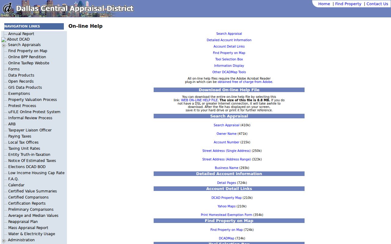
The help view reinforces why a street-by-street result is an account or parcel starting point, not a complete roll of everyone at an address.
Search Sachse Streets in Collin CAD
Collin CAD offers By Owner and Advanced routes, which can be especially useful when an address was written differently in a deed. Street Number and Street Name can be used with City, while Subdivision or Condo, Geographic ID, Property ID, Legal Description, Block, Tract, Lot, and Tax Year offer parcel-based alternatives. The owner field uses a last-name-first format, and the legacy search documents an asterisk wildcard. Collin's result card can carry the link between a street result and the lot, block, abstract, or geographic identifier used in official records.
| Collin CAD field group | Practical use |
|---|---|
| Owner Name | Optional last-name-first search; simplify the name if needed. |
| Street Number and Street Name | Optional address inputs; omit a suffix when a direct search fails. |
| Property ID and Geographic ID | Exact parcel identifiers; the geographic ID has 13 to 18 characters and accepts optional dashes. |
| Subdivision, Condo, Neighborhood | Selectable geographic terms that can bridge a street to a plat area. |
| Legal Description and Abstract | Text or listed fields for the deed-facing parcel description. |
| Block, Tract, Lot, City, Tax Year | Detailed or geographic filters available through advanced or legacy search. |
Collin CAD says its legal descriptions and acreage are for research, not a title opinion. That warning matters when a street directory result has a familiar name but a different parcel. Match the street, legal description, and transfer record before deciding it belongs in the same chain.
Sachse Street Directory Parcel Keys
A parcel is the tax and map unit for a piece of land. A situs address is its physical location. A mailing address is where tax correspondence goes. Those values often match, but they do not have to. A trust, business, representative, or owner living elsewhere can receive mail. A homestead exemption is evidence of an exemption claim, not conclusive proof of who occupies the property. Public appraisal rolls generally do not index roomers, renters, or all household members.
- Parcel
- The mapped property unit linked to an appraisal account, identifier, and tax data.
- Situs address
- The physical parcel location, distinct from an owner's mailing correspondence address.
- Plat
- A recorded subdivision map that names lots, blocks, easements, and legal geography.
- Criss-cross directory
- A reverse-style directory that may connect an address to a listed subscriber for a particular edition.
When the street string fails, compare the subdivision plat, lot or block, abstract, and geographic ID. Sachse has no verified citywide street-renumbering or renaming guide in the reviewed sources, so an old address should not be forced into a modern numbering pattern.
Map a Sachse Street Parcel
The city ArcGIS viewer is the map bridge between an address and its parcel context. It can be used for city limits, parcels, subdivisions, zoning, thoroughfares, and flood context, but the current live layer names and result-panel fields require visual confirmation. Dallas CAD documents Zoom, Pan, Identify, Parcel Identify, Measure, Layers, Legend, Print, and Find. In Collin County, the public GIS REST catalog names Address_Points, Appraisal_District, Boundaries, Cemeteries, Election, flood-year layers, School_Districts, Utilities, Transportation, and 911 services.
Click or identify the subject parcel, save the geographic or parcel ID, then return to the relevant CAD for owner and legal-description details. Map layers explain geography; they do not prove occupancy. The county line, flood layer, school district, and election layer can all have a different purpose.
Sachse Street Records by Address
Address-keyed records have different keepers and limits. The useful question is not whether one portal contains every name on a street, but which record can verify the next link. CAD accounts, map layers, official-records indexes, city permits, and regional directories form a chain when their address or legal-description fields agree.
| Address record | Custodian | Street-level value | Access route |
|---|---|---|---|
| Appraisal parcel | Dallas CAD or Collin CAD | Owner, situs, mailing address, legal description, values, exemptions | Online address, owner, ID, or map search; office counter and phone fallback |
| GIS parcel | Sachse, Dallas, or Collin map systems | Parcel shape, boundaries, and geographic layers | Public map and identify tools |
| Official-records index | Dallas County Clerk or Collin County Clerk | Grantor, grantee, instrument, recording date, legal description | County portal; clerk, archive, or library fallback |
| Subdivision plat | County clerk and CAD | Lot, block, plat name, easements | Collin Plats search or county plat records |
| Permit record | Sachse Development Services | Jobsite, work type, inspection or project timing | SmartGov public route, then a request for complete or older files |
| Reverse directory | Dallas Public Library and archives | Historical subscriber or address clue | Print, microfilm, and regional phonebook holdings |
The county clerk's official index is the next stop after a CAD result, not a generic records request. Dallas Public Search accepts grantor or grantee, subdivision, document type, document number, and date terms. Collin's instructions start with a CCAD legal description, then owner name, recorded-date sorting, and a purchase-year match. Both clerk counters, records desks, written requests, library microfilm, TSLAC, and FamilySearch remain part of the fallback chain for older material.
See the Dallas County official-records index as an example of the grantor-grantee search interface used after the parcel step.
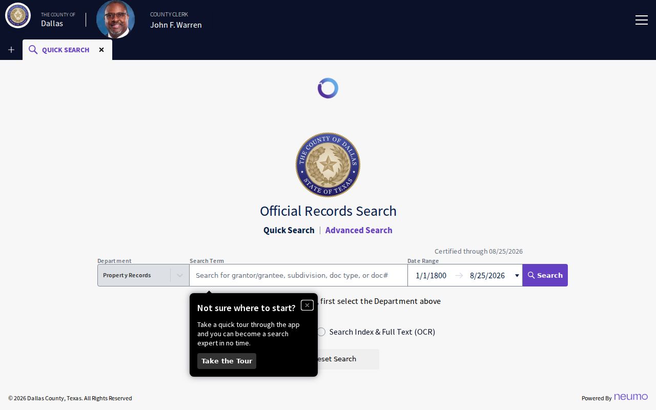
The public index supplies leads such as parties, document type, date, and legal-description text, while an image or certified copy is needed to verify an instrument.
Move from a Sachse Parcel to Deeds
Search the current owner as a grantee near the purchase date, then compare the deed's legal description with the CAD card. Record the instrument number, recording date, grantor, grantee, and any prior-instrument reference visible in the record. The seller, called the grantor, becomes the next lead when researching a prior transfer. Search both name orders and a date window, because a single same-name result is not enough.
Collin's Historical Records mode explicitly covers 1843 through 1975. Dallas County's official portal does not state its oldest online index year or exact imaging cutover. That gap should remain a gap. When an older Dallas deed does not appear online, move to the clerk, deed books, TSLAC microfilm, Dallas Public Library, or FamilySearch rather than inventing a cutoff. Note: A clerk index identifies a recorded event, while a certified copy is the document route for formal verification.
Sachse Street Permits and Jobsite Data
Sachse moved new permit work to SmartGov on July 8, 2025. The public system offers notices, parcel search, reports, and documents, and a permit can provide a date for a remodel, addition, roof, pool, new structure, or inspection. It cannot prove that an applicant lived at the property. Older or complete files may require a request for existing city documents under the Texas Public Information Act.
A SmartGov contractor site location is the contractor's business address, not the project jobsite. Use the jobsite or project-address field when matching a permit to a Sachse street. A written request should describe existing records, not ask city staff to answer a research question or create a new list.
The Sachse Building Permits and Inspections page documents the SmartGov transition and the public route.
This city source is useful for tying a record to the actual project location instead of the contractor's separate business location.
Sachse Street Directory History Clues
For a past address, regional volumes are more useful than a claim of a standalone Sachse directory. Dallas Public Library holds Southwestern Bell regional books for 1990–91, 1993, and 1998–99, an area-wide Garland, Rowlett, Sachse, Wylie directory for 2005–06, and Wylie, Sachse, Murphy books for 2005 and 2007–09. Inclusion varies by edition. A subscriber entry is an address clue for that edition, not proof of every occupant or owner.
UNT's Wylie-Sachse newspapers cover 1948–2011 and can add address, obituary, community, or development leads through OCR and metadata searches. The historical directory collections themselves have their own limits and shelf details on the Sachse Directory Book. Pair an old street string with a subdivision plat, legal description, and county branch before treating it as the modern address.
Limits of a Sachse Street Directory
A public parcel card can show a recorded owner, not a complete household. My Voter Portal is a one-person confirmation that requires name, county, date of birth, and ZIP; it is not a public street roster. Protected voter addresses, qualifying appraisal addresses, utility customers, and Address Confidentiality Program participants may not appear in ordinary address research. A no-match can reflect a spelling change, recent move, county mismatch, or protection, not proof that a person never lived in Sachse.
Lawful use. Sachse street and address records are for personal, lawful research. Do not use any result to stalk, harass, intimidate, or harm another person.
Use an address record to understand a parcel, property history, family connection, or civic record. Keep sensitive attachments private and verify an important finding with the office that holds it.